Bantjes, Rod, “Document name.html,” in Eigg Mountain Settlement History, last modified, 29 March 2024 http://people.stfx.ca/rbantjes/gis/txt/Introduction.html.
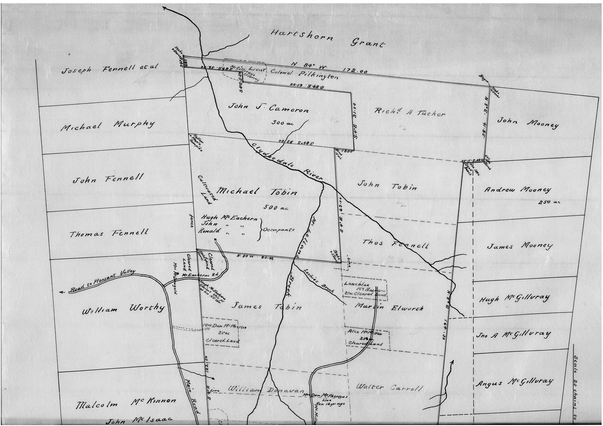
Plan B-11-1, McLellan’s Brook, 1912 (Eigg Mountain Settlement History)
…apparently using magnetic north of 1912 (23º 29’ declination)
-surveyed by Albert McKean
Begin: marked with stake and stones
1...thence N 5º E
…41.85 (327.7 yds) to ccc 1886 birch
2...thence N 89º E
…11.30 (248.6 yds) to ccc 1886 dead beech
3...thence N 5º E
…164.30 (3614.6 yds) to birch 6”
4...thence N 87º E
…78.16 (1719.52 yds) to birch 7”
5...thence N 5º E
…3.06 (67.32 yds) to stake and stone
6...thence S 84º E
…47.76 (1050.72 yds) to fir 8”
7...thence S 4º E
…122.50 (2695 yds) to stake and stones
8...thence N 48º W
…80.00 (1760 yds) to stake and stones
9...thence S 4º E
…63.00 (1386 yds) to birch 16” dia.
10...thence S 84º E
…13.00 (286 yds)
11...thence S 4º E
…31.00 (682 yds)
12…thence S 84º E
…61.00 (1342 yds)
13…thence S 4º E
…5.50 (121 yds)
14…thence S 84º E
…32.00 (704 yds)
15…thence S 4º E
…6.85 (150.7 yds) to stake and stones
16…thence N 84º W
…172.00 (3784 yds) to place of beginning.
Plus an additional line
…beginning at birch 16” dia.
…thence S 84º E
…93.00 (2046 yds) to fallen maple rampike

