Bantjes, Rod, “Document name.html,” in Eigg Mountain Settlement History, last modified, 29 March 2024 http://people.stfx.ca/rbantjes/gis/txt/Introduction.html.
Land Tenure – Lot 601 (Eigg Mountain Settlement History)
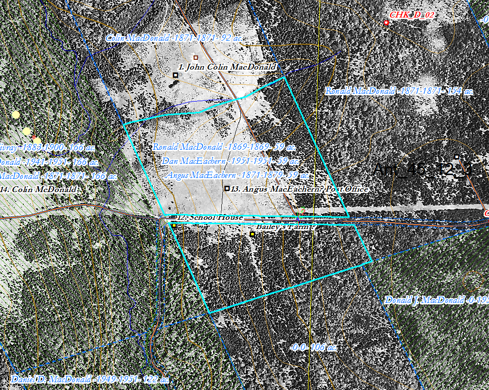
This land on Brown’s Mountain was sold by Ronald MacDonald to Angus MacEachern in 1871 (see deed D_20_560). Ronald describes it as being 80 acres with Colin MacDonald to the north. There is a Hugh and an Allan to the north of the full lot and a John Colin on the north half of the property. This is one of the “range” properties that were part of the Hartshorne Grant. These were a minimum of 100 acres and this one was 130 acres – something local people should have known. I am assuming that Ronald had earlier split the lot and considered Colin’s to be a separate lot. (See the norther half, Lot 511).
Figure 1 – Lot 601 on the ArcGIS map, 2018, with georeferenced 1945 aerial photo
The line I have drawn between the two halves of the property is a guess based on the location of dwellings and the pattern of fields. The stream, evident in the 1945 aerial photo, seems like a logical demarcation line (see Figure 1).