Bantjes, Rod, “MacDonald_271,” in Eigg Mountain Settlement History, last modified, 8 August 2015 (http://people.stfx.ca/rbantjes/gis/txt/eigg/introduction.html).
Allan MacDonald (Eigg Mountain Settlement History) (Map Location)
15. Allan MacDonald. The site is listed as A. MacDonald on the Church Map. Colin and Christina list it as “Allan MacDonald, father of the MacDonald brothers Alexa, John, Ronald, Dan.” It is located on Brown's Mountain, north of the main road.
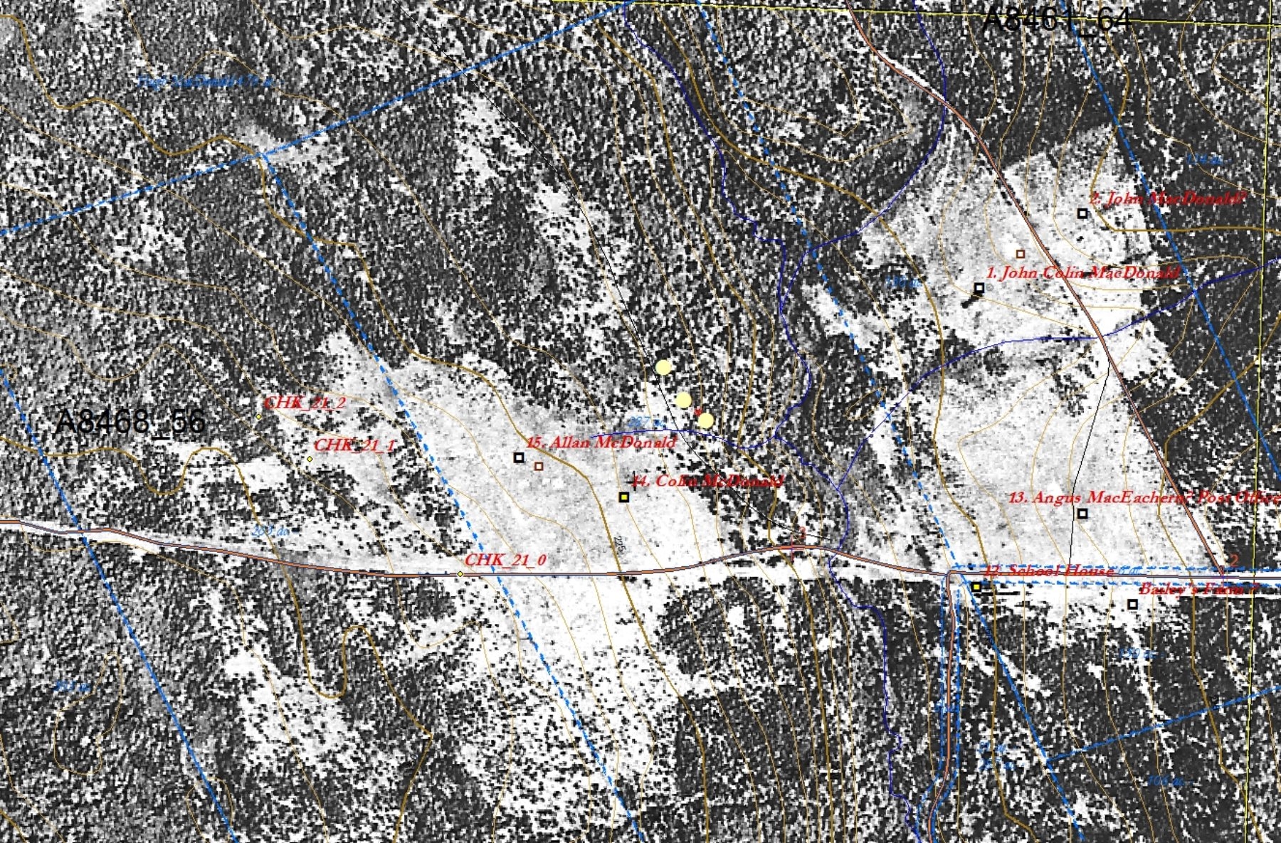
Figure 1 – Aerial photo as a layer georeferenced to the map.
Figure 1 shows what the site looked like in 1945. Aerial photos when georeferenced to the map are powerful tools for locating old farm sites. Here you can see open fields being overgrown by white spruce (which is generally darker than hardwood forest in aerial photos). You can also see that Allan MacDonald and his neighbor to the west observed the legal boundary (the blue dotted line). The neighbour’s field was probably abandoned earlier and is more overgrown. I have added waypoints (“CHK_21_0” to “CHK_21_3”) to guide us on the ground. (Any points recorded on the map can be downloaded to the GPS which then can guide us to where those points would be in the landscape.) In this case I wanted us to follow what appears to be an old driveway (in retrospect I think the line is probably a small stream bed that is not marked on the digital map). I have erased the “CHK” waypoints for Allan MacDonald’s house and barn since we located them in the field with GPS. The initial “CHK” points were over the two white spots just below the black and brown square symbols. You can see a clearer example of how a collapsed building shows up as a fuzzy white spot just to the left of John Colin MacDonald’s barn. For more on finding farm sites see Finding Places.
Allan MacDonald’s cellar is oriented at 282º (west). Assuming that the cellar entrance is at the back, the house probably faced west, uphill, away from the barn. The west foundation wall is 25 ft and the north wall is 36 ft. The cellar is centred east to west, 10 ft. in from the east wall. It measures 12 by 25.
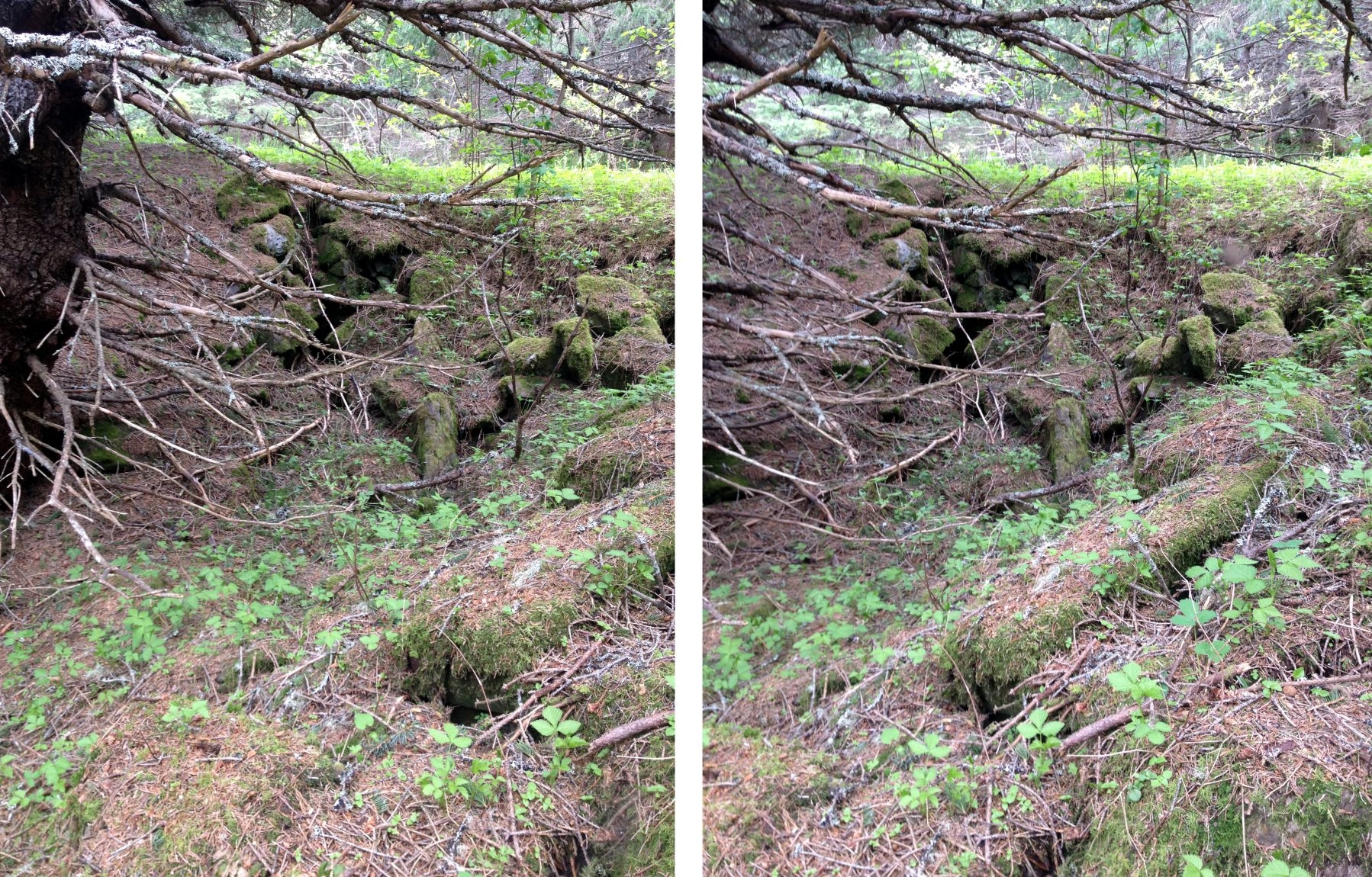
Figure 2 – Paired photos looking across the cellar to the south.
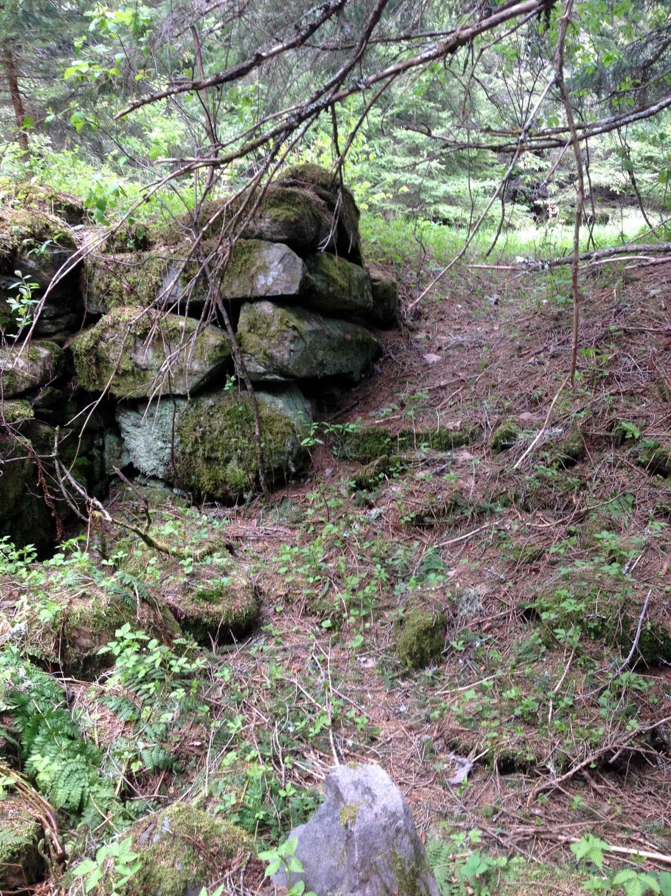
Figure 3 – A view from the bottom of the cellar looking up to the entrance on the northeast corner.
June 5, 2015