Bantjes, Rod, “Document name.html,” in Eigg Mountain Settlement History, last modified, 29 March 2024 http://people.stfx.ca/rbantjes/gis/txt/Introduction.html.
Land Grant Book G, p. 50 (Eigg Mountain Settlement History)
Tobin Grant 1816
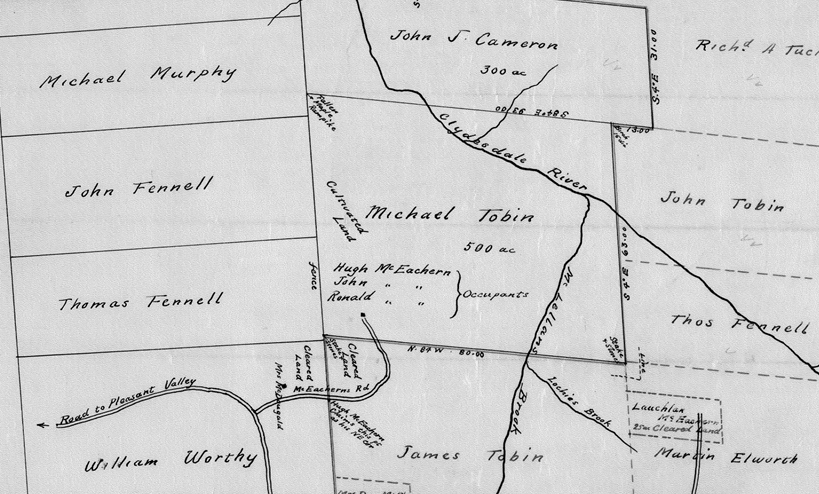
These two Tobin lots include “Lame Angus’s” land plus the lower part of Power’s Brook (see Figure 2). The surveyor of Plan B-11-1 in 1912 lists Hugh MacEachern and sons John and Ranald as “occupants” not owners living on “cultivated land” on this grant. The probate records of 1918 indicate however that Ranald held title to the land which was auctioned at his death.
Figure 1 – Detail of Plan B-11-1 (1912) (with south at the top of the sheet – inverting normal orientation)
The surveyor describes the starting point and boundaries of Michael Tobin’s land with reference to Charles Wentworth, Joseph Fennel and Michael Murphy in a way that is clearly in contradiction with the Grants Index as well as Plan B-11-1 (which put these lots considerably further south).
Interestingly, this survey describes this lot as one of the first range of “farm lots” in the rear (i.e. north) of the Addington Grant. Apparently they were meant to be farmed.
Later note: western third reconveyed to crown by Donald J. McDonald, April 6, 1945 registration book 80, page 353, document number 126. [How could this land be reconveyed to the crown in 1945 when it reverted to the crown in 1912?]
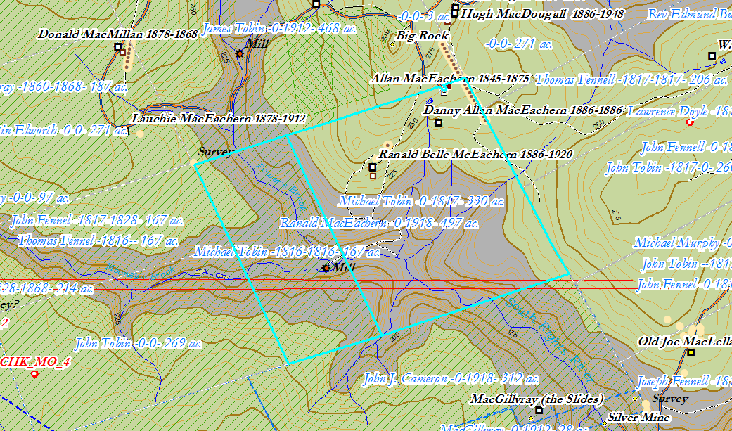
Figure 2 – Tobin Grants on the ArcGIS map, 2018.