Bantjes, Rod, “G_O_24.html,” in Eigg Mountain Settlement History, last modified, 14 August 2015 (http://people.stfx.ca/rbantjes/gis/txt/eigg/introduction.html).
Book O, pg. 24, April, 1829 [scan] (Eigg Mountain Settlement History) (Map Location)
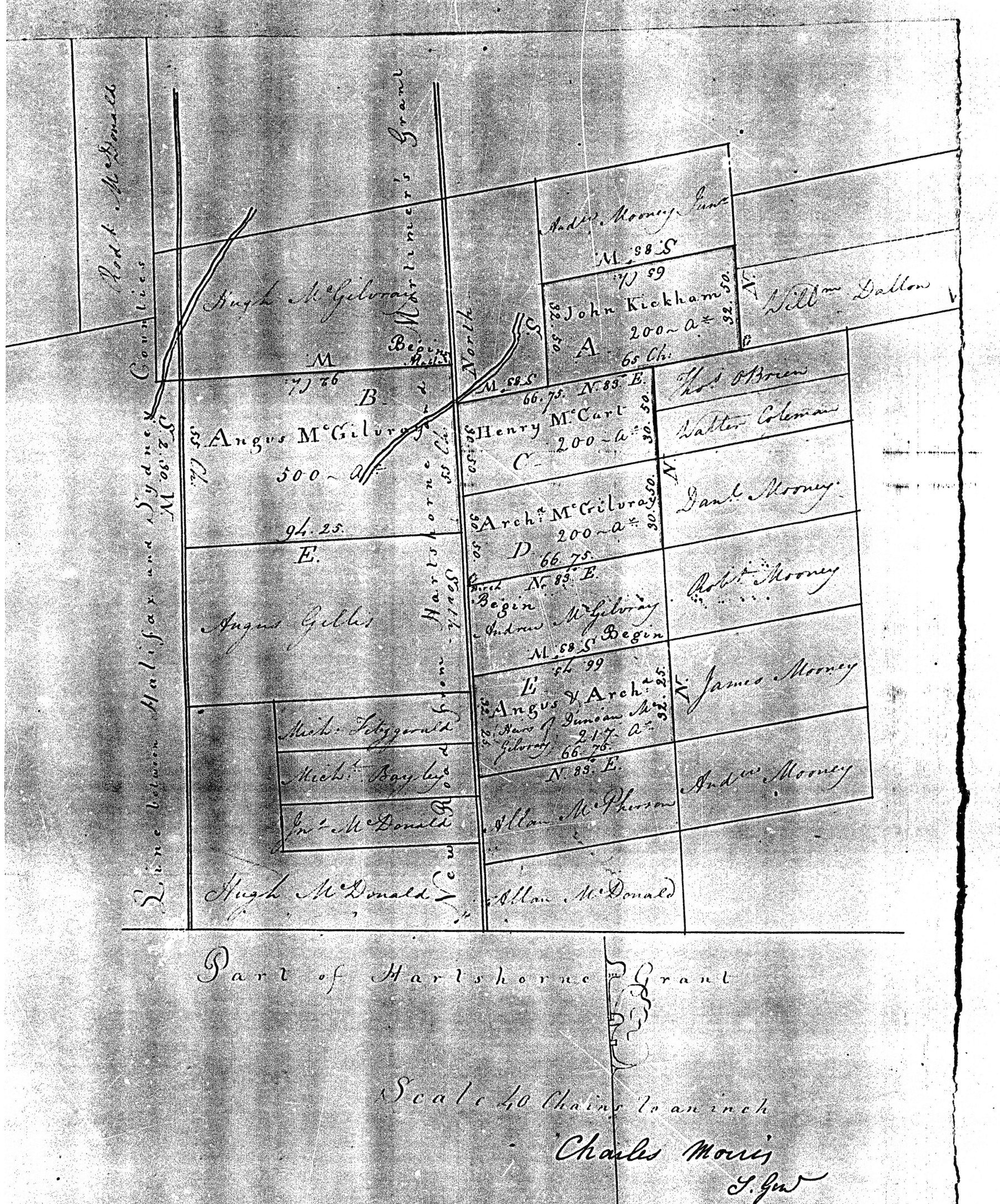
Kickham, McCart (very interesting plan)
Grant to …John Kickham, Angus McGillivray, Henry McCart, Archibald MacGillivary Angus McGillivray, Archibald MacGillivary, heirs of Duncan MacGillivary all of the County of Sydney 1317 acres of land in the same is situate lying and being within the said County in the following proportions to wit unto the said John Kickham 200 acres containing in the tract marked A on the annexed plan unto the said Henry McCart 200 acres contained in the tract marked C. on said plan, unto said Archibald MacGillivary 200 acres contained in the tract marked D. on said plan which said tract A, C and D. are abutted and bounded as follows; that is to say,
Beginning at the Northwest angle of Andrew MacGillivarys land on the eastern side of the new road to the Hartshorne Grant
…thence running north 83° East 66 chains and 75 links,
…thence North 61 chains
…thence north 83° east along the northern side line of Thomas O'Brien's land to the southwest angle of William Dalton’s land,
…thence north 32 chains and 50 links,
…thence south 83° West 65 chains,
…thence south 34 chains and 50 links,
…thence south 83° west to the road aforesaid
…thence by the course of said road southerly to the place of beginning according to the annexed plan...
Plan: