Bantjes, Rod, “Google_Earth_Graphics.html,” in Eigg Mountain Settlement History, last modified, 14 August 2015 (http://people.stfx.ca/rbantjes/gis/txt/eigg/introduction.html).
Google Earth Graphics (Eigg Mountain Settlement History)
Click here to download the Google Earth map.
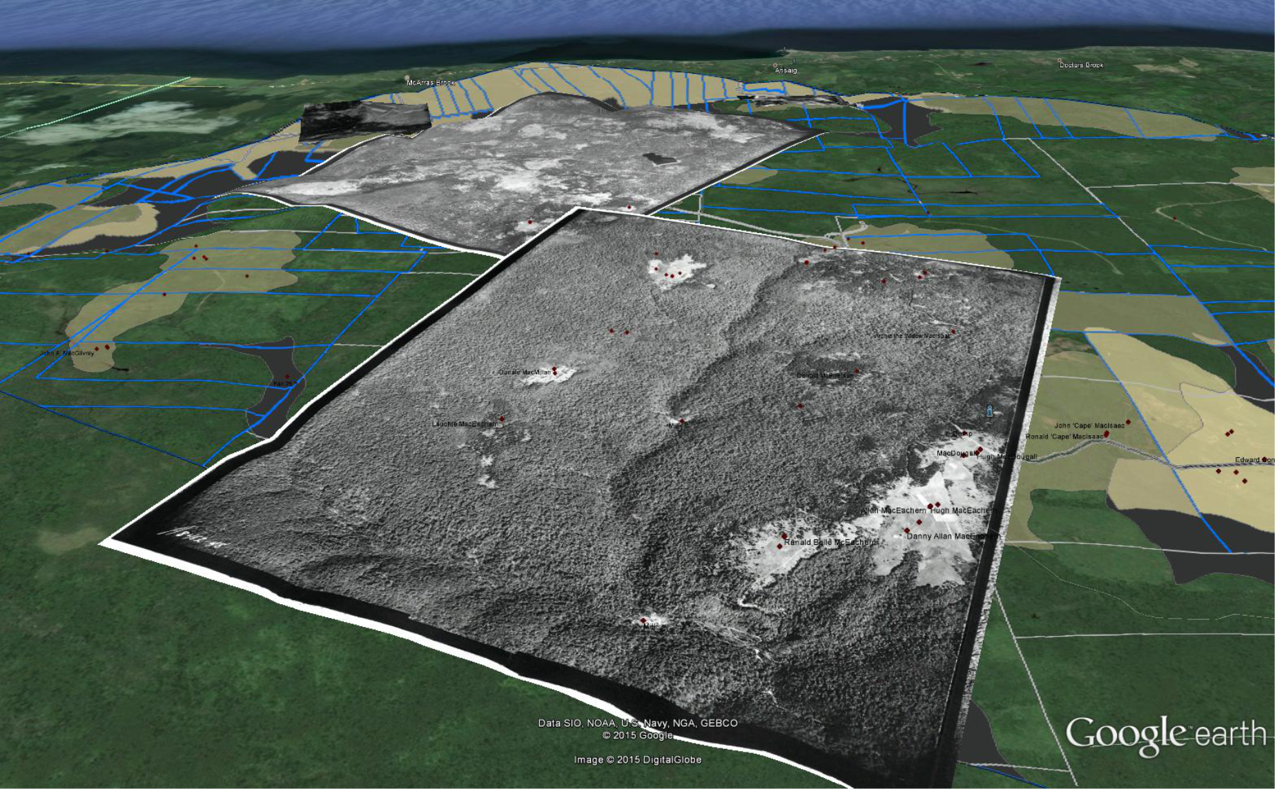
Figure 1 – Screen Shot of Google Earth Overlays for Eigg Mountain. The little red dots are clickable so that you can find out more about each site.
You can zoom in and fly low in and around the valleys and hills of Eigg Mountain as they were in 1945. While historic aerial photographs are very evocative of past landscapes in themselves, the sense they give of being there in the past is enhanced when they are draped over the topography in Google Earth. Google Earth adds a 3D effect as well as perspective (i.e. the landscape seems to recede into the distance). When the user shifts her apparent position and angle of view both effects change just as they would if she were flying over the landscape. Aerial photos were often taken in the morning or evening so that the sun shone at a low angle over the topography and heightened the light and shadow contrasts (or chiaroscuro as the painters call it). The chiaroscuro of the aerial photograph therefore further enhances the depth illusion of the Google Earth topography.