Bantjes, Rod, “Document name.html,” in Eigg Mountain Settlement History, last modified, 29 March 2024 http://people.stfx.ca/rbantjes/gis/txt/Introduction.html.
Gillis, John “Red” (1782-1868) (Eigg Mountain Settlement History)
See probate file A-383
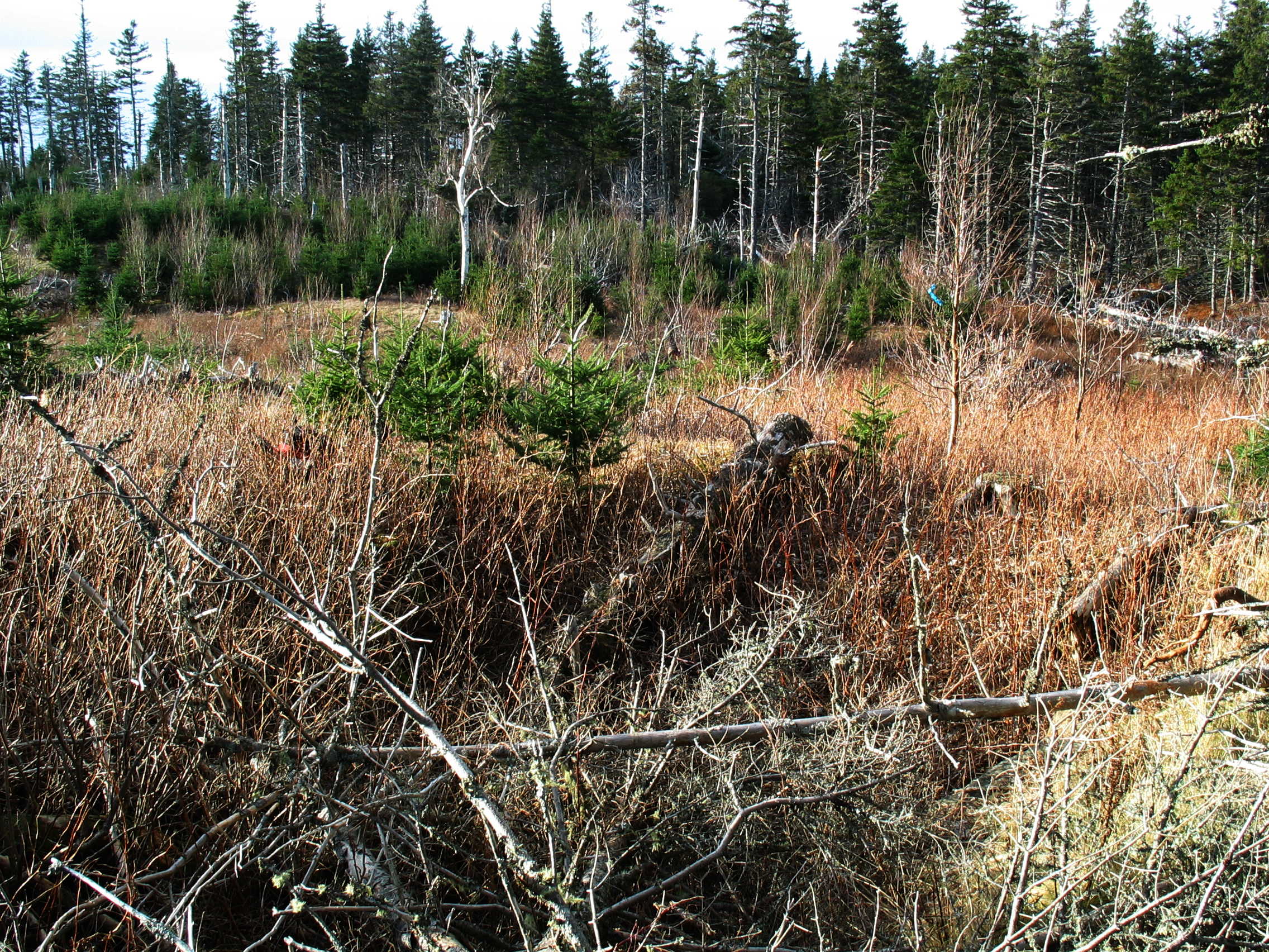
This site is a well-defined basement on the north side of a hill overlooking a small valley that does not show on the 1:10,000 topographic map. The builder of the house, John “Red” Gillis (i.e. Son of Red John Gillis) was one of the late pioneers on Eigg Mountain on the “brow” of the mountain. When his fields were clear he would have had a fine view down to the Northumberland Strait. This site is east of another John Gillis. John Red Gillis’s sons built elsewhere. He was the last to live here and died around 1880 (?).
John Red Gillis died at the age of 86 years on May 24, 1868 and left a will A-383. He was born about 1782 in Arisaig. His probate file contains an inventory and he owned 300 acres. (The list of his assets also included a "dung fork").
Son Lauchlin is found in division 2 page 21 line 14 and of the 100 acres he owned 40 were improved and 10 in pasture, Angus is found in division 2 page 21 line 5 and 40 acres were improved and 10 in pasture of the 100 acres he owned. Looks like Flora lived with her brother Alexander and combined their lands to total 100 acres with 40 improved and 10 in pasture. They are found in division 2 on page 20 line 19.
Two other sons of John Red Gillis - John and Donald received money but no land.
I am following the sons of John Red Gillis through the subsequent census to see where they ended up. I know that Lauchlin left the mountain and in 1881 and 1891 was living in or near the town of Antigonish with his wife Mary. He worked as a labourer and general servant.
The cellar measures approximately 21 by 24 ft with a foundation that extends 5 more ft to the west. The building was oriented at 145 degrees with the 26 foot front probably facing north looking towards the sea. The drive apparently came up from the east to this side of the house. To the west, sunk into the side of the hill is another small depression measuring 15 by 8 ft. which may one time have been a root cellar. Charlie and I looked, but found no clear evidence of a barn or well.
Figure 1 – A view across the foundation to the north.
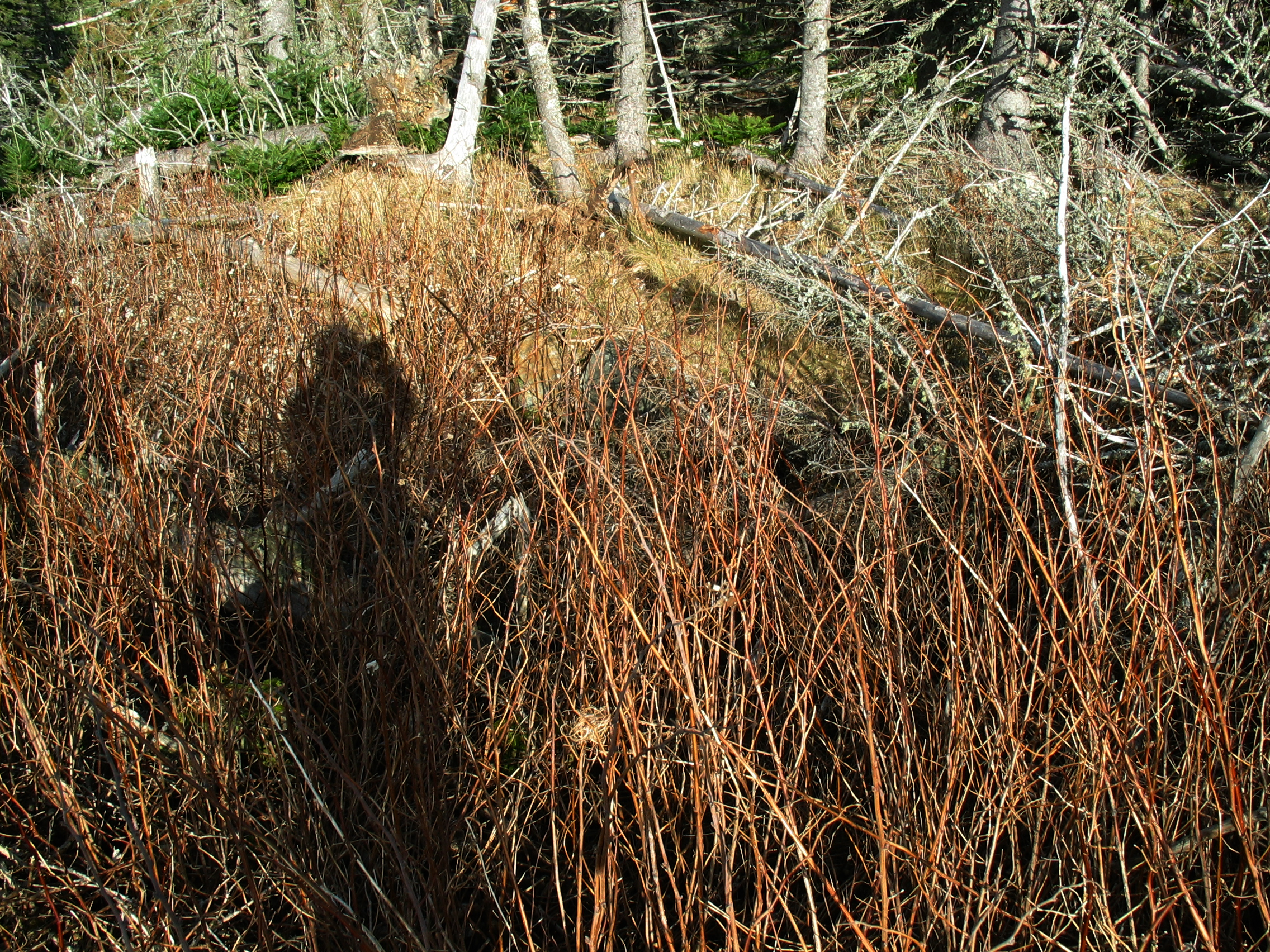
Figure 2 – A view across the foundation to the east. You can just see some rock below the photographer’s shadow. R Bantjes, December 1, 2005.
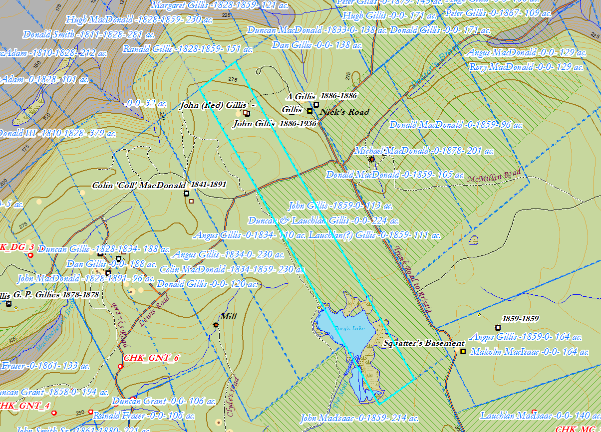
Figure 3 – John Red Gillis’s property according to local knowledge as depicted on the ArcGIS map 2018. Does this location fit with evidence from the Probate file A-383?