Bantjes, Rod, “Document name.html,” in Eigg Mountain Settlement History, last modified, 29 March 2024 http://people.stfx.ca/rbantjes/gis/txt/Introduction.html.
Lot 164 (Eigg Mountain Settlement History)
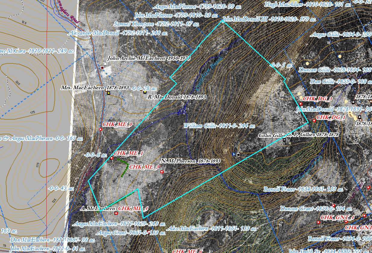
Listed on the Church Map (1878) as belonging to G.P. Gillis, on the Geological Survey Map, 1893, as belonging to Colin Gillis. The house is actually on the lot to the south, but Charlie Teasdale insists this is the Gillis lot. It makes sense from a practical point of view for the Gillis’s to have occupied this whole spur north of the ravine.
However the lower portion to the west was occupied by Neil Macpherson in 1879 (Church) who believed that he owed it since he willed it to relatives at his death in 1905 (A-…). I have reproduced the ArcGIS map with an aerial photo that indicates the cleared land and the probable boundaries that he and the Gillis’s may have respected – the east branch of Knoydart Brook at the bottom of the Mountain slope.
Figure 1 – Detail of AcrGIS map, 2018, with georeferenced 1945 aerial photo.