Bantjes, Rod, “Maps_Explorer.html,” in Eigg Mountain Settlement History, last modified, 14 August 2015 (http://people.stfx.ca/rbantjes/gis/txt/eigg/introduction.html).
ArcReader Version of Eigg Mountain Map (Eigg Mountain Settlement History)
The ArcReader version is the best way to explore the Eigg Mountain map. I designed the whole project with this form of access in mind. You can explore the landscape by zooning in (Figure 2) and panning from place to place. This way you will find points of interest that you can click on (see Figure 2) and dive into a hyperlinked set of descriptions and illustrations. Or if you know in advance that you want to look for a particular settler you can search for them by right-clicking either the “Historical Features” layer (see Figure 1) or the “Land Grants” layer and typing in their name.
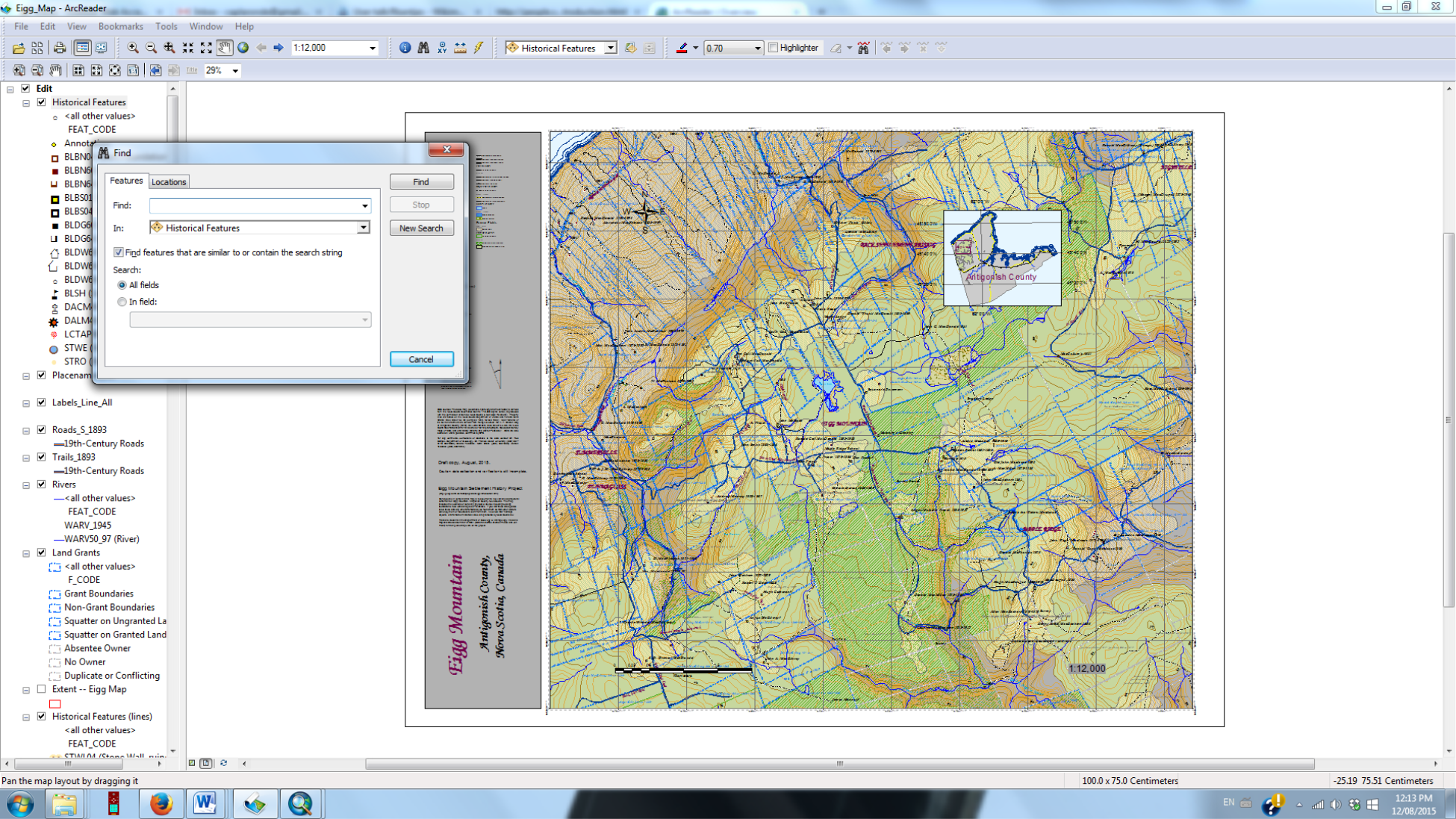
Figure 1 – The Map in ArcReader. I have right-clicked on the layer “Historical Features” and can now type in the name of anyone I want to search for.
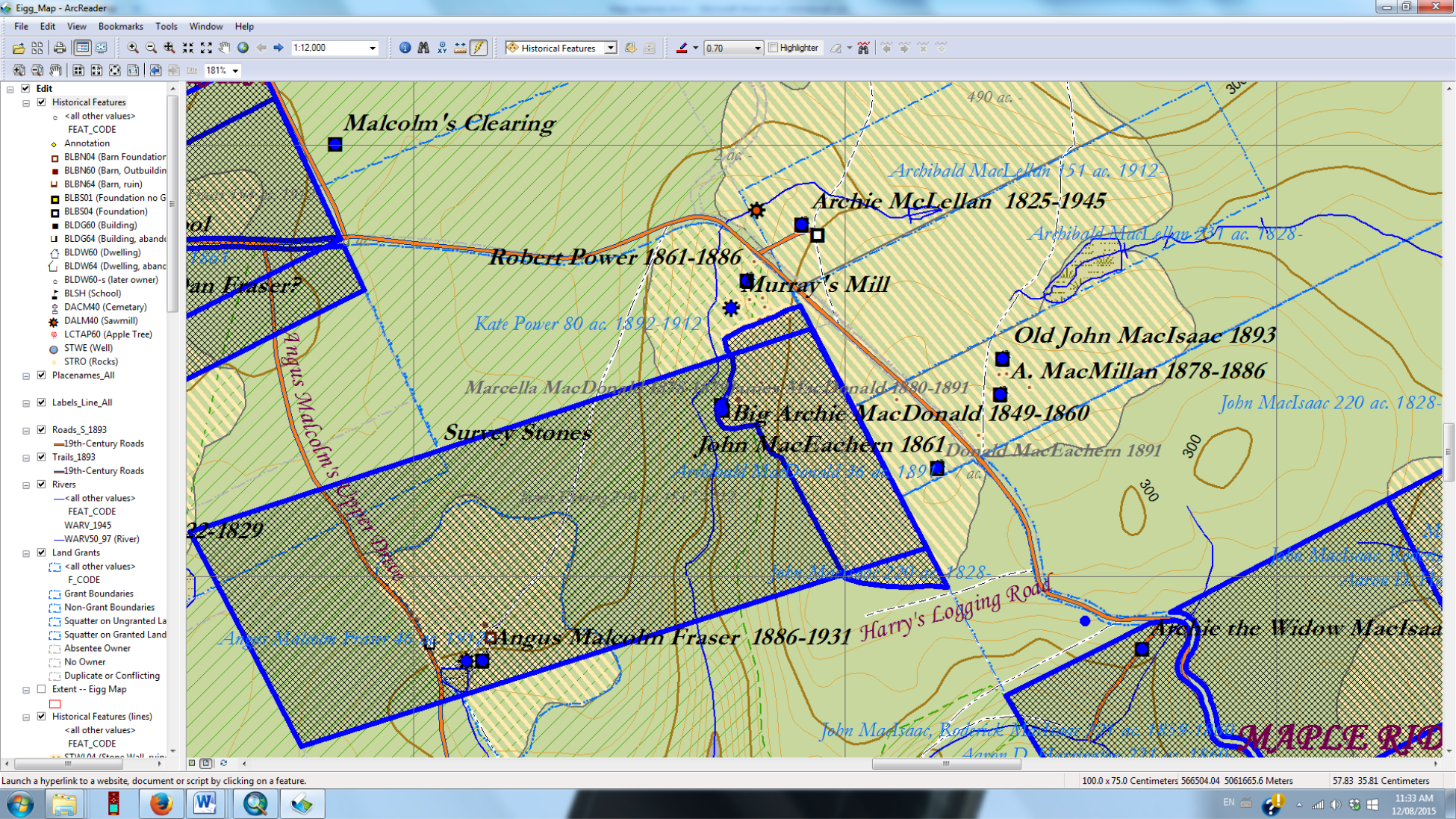
Figure 2 – Hyperlinks. Note that there is a button (with a little yellow icon) depressed on the tool bar. This turns the cursor into a little lightning bolt that you can use to click on any point or area highlighted in blue. Clicking will lead you to text and photographs describing the place, person or thing represented on the map.