Bantjes, Rod, “Mooney_Fraser.html,” in Eigg Mountain Settlement History, last modified, 14 August 2015 (http://people.stfx.ca/rbantjes/gis/txt/eigg/introduction.html).
Mooney /Fraser Site (Eigg Mountain Settlement History) (Map Location)
This site is marked as “D. Fraser” [Donald [Ranald] Fraser] on the Church map of 1879. However the Land Grant index of 1953 shows the original grantee to have been Andrew Mooney. This is a curious case where records of land ownership indicate the parcel changing its location north and south and attribute ownership to it inconsistently. It is also one of the most clearly defined fields in the 1945 aerial photos – its north and south borders are dead straight and the southern boundary has one of the longest straight rock walls on the mountain. The owners were fastidious about working this field and it was probably one of the last to be in use on the mountain. The toil involved is attested by a great many rock piles, and an old scythe giving evidence that it was harvested by hand.[1] However, the south boundary, that settlers took such pains to inscribe upon the land, does not correspond with any officially recorded property lines. In every practical sense this line was more “real” than the legal lines and for this reason I have added it to the map.
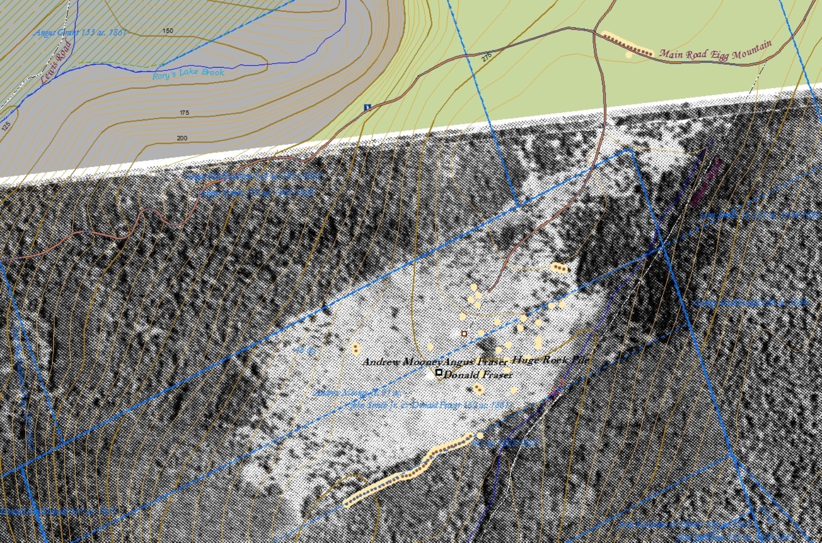
Figure 1 – Map Image: Here is what the field looks like in the aerial photo of 1945 which is here layered onto the map. Note the light-coloured patches to the left of the house and barn (as located by GPS). These are how collapsed buildings often show up on the photos.
We had some difficulty locating the house and some slight doubt remains about whether there might have been two sites here – one belonging to the Mooneys and one to the Frasers. Kenton remembered the house foundation to have been in the vicinity north of the barn. Charlie remembers a foundation higher up the road squarely within the Crown strip. He recalls it being just overt the brow of a low ridge running roughly east-west. We found such a ridge with rocky outcrops, but neither foundation nor other evidence. Both remember this as a Mooney property and have no knowledge of a Fraser having been near here (Eigg Mountain, November 2, 2005). Since 2005 the Teasdales both accept that this was at least at one time a Fraser property. Charlie located a house foundation lower down to the south west in 2007.
The house appears to have faced southwest but the land slopes away to the southeast (November 10, 2007). The cellar measures 24 by 16 (?) ft. The house was 24 by 30 ft extending out the southwest of the cellar with a probable “porch” extension another 12 feet further southwest. It was oriented 327 along the long wall. The a barn foundation is roughly 27 by 24 ft.
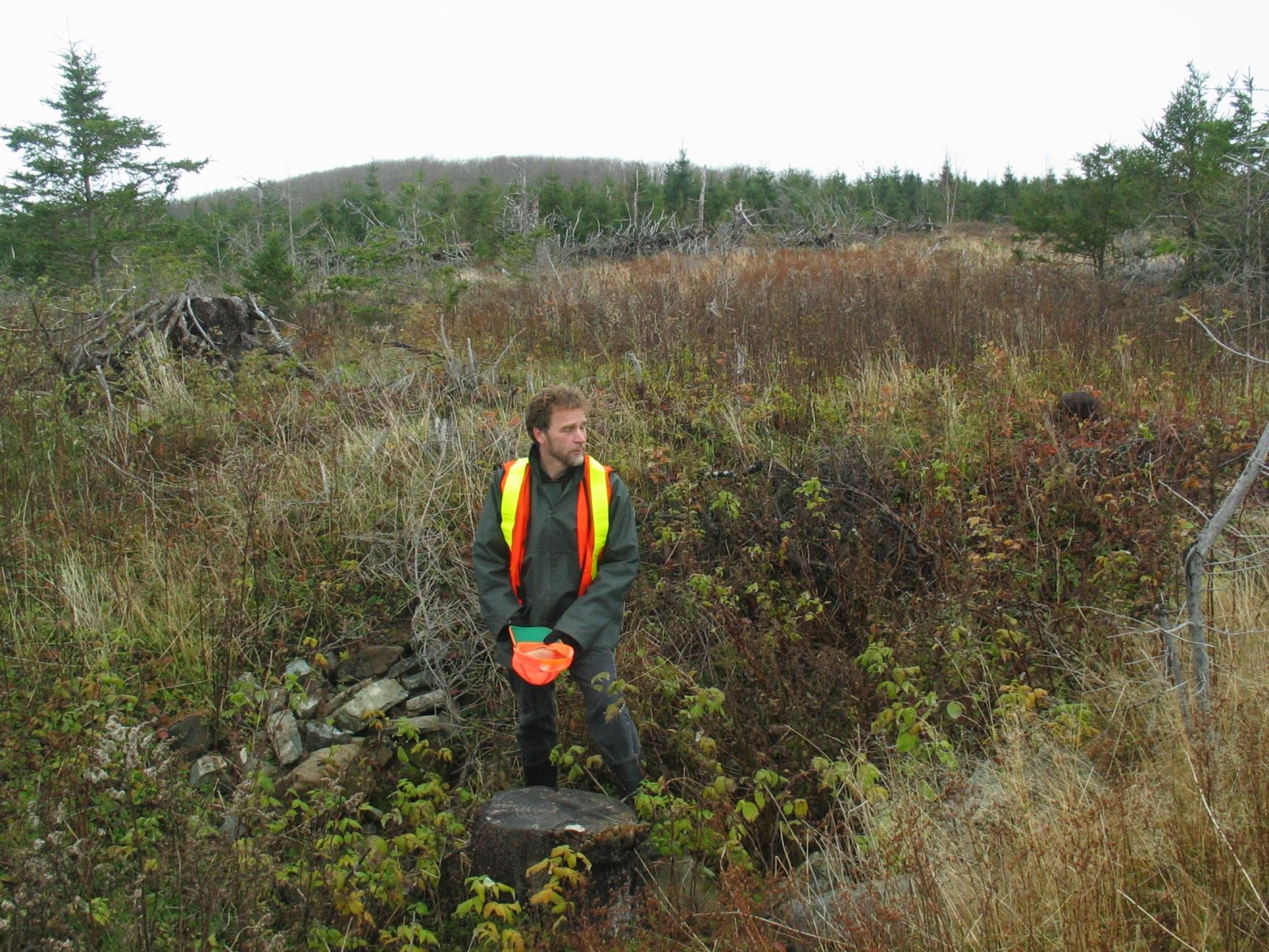
Figure 2 – The house foundation looking northwest. Eigg Mountain, November 10, 2007
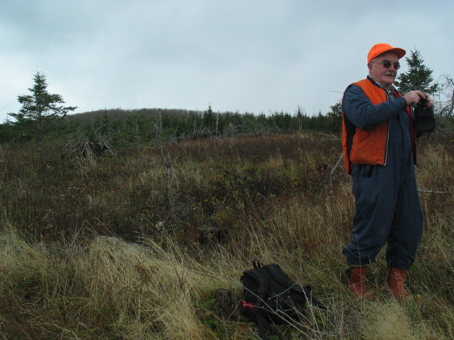
Figure 3 – The house foundation looking northwest. Eigg Mountain, November 10, 2007
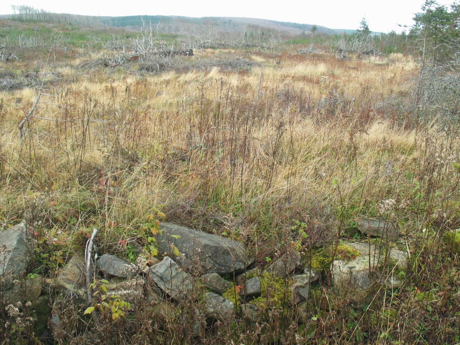
Figure 4 – The house foundation looking southeast. Eigg Mountain, November 10, 2007
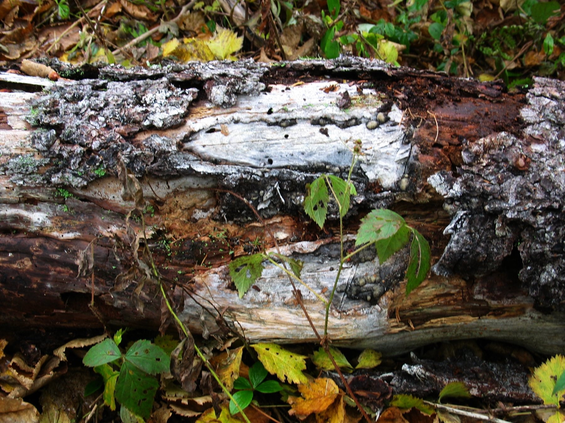
Figure 5 – A fallen boundary marker inaccurately placed just north of the Mooney-Crown line near the barn. Wood harvesters, not farmers, probably placed it here. The 1945 aerial photo shows an overgrown field at this site. The field traversed this boundary as though these were a single property.
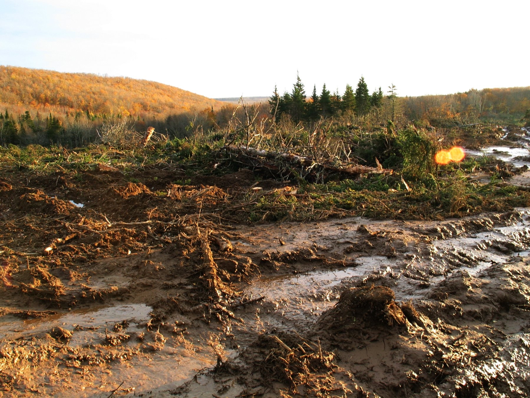
Figure 6 – A view of the road, churned up by logging equipment. The camera is looking south. The skidders were leaving deep ruts in the mud – a foot to 16 inches. Charlie points out that this means that the soil was deep on these fields. Eigg Mountain, November 2, 2005.